How to estimate tank diameter from satellite imagery
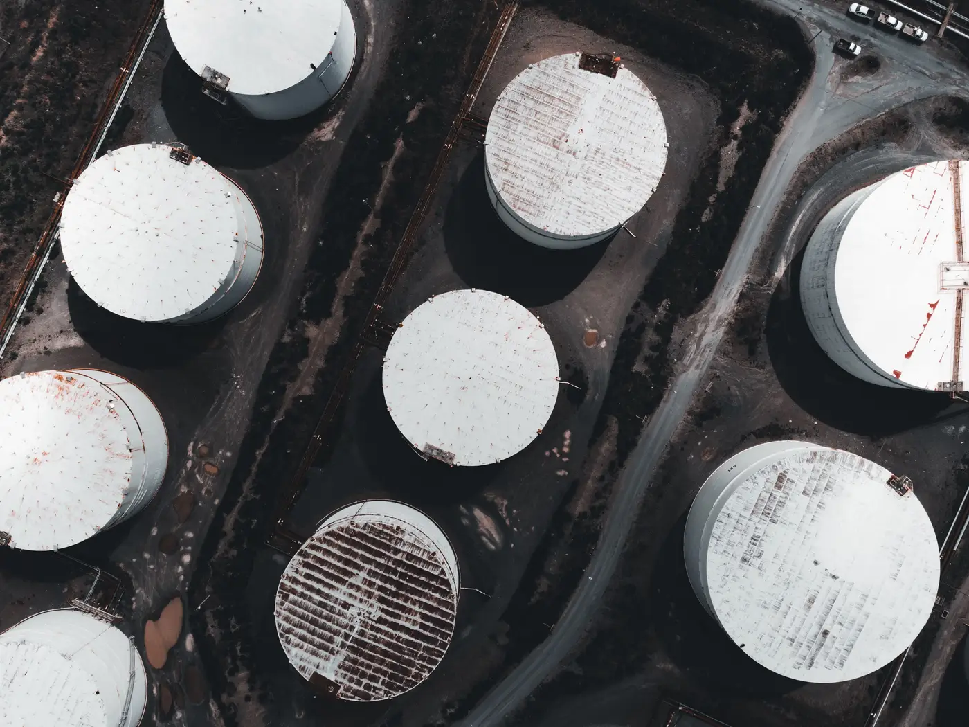
Anyone building a storage estimate off commercial imagery runs into the same wall first: the tank's diameter is the number you need before you can do anything else, and nobody prints it on the roof. Here's a working method for pulling it off the image yourself, and where that method runs out of road.
Counting pixels across the rim
Start with the image metadata. You need the ground sample distance (GSD), the real-world size of one pixel, usually somewhere between 0.3 and 0.5 meters for commercial sub-meter providers. Without it you're just measuring pixels, not meters.
Find the widest point of the tank in the image, the diameter line running through what looks like the center of the circular roof, and count pixels edge to edge. Multiply that pixel count by the GSD and you have your diameter estimate. Do this on two or three lines through the tank, not just one, and average them. Floating roofs aren't always perfectly centered in the frame, and a single bad line can throw the number off by a meter or more.
Watch the look angle. A satellite rarely shoots straight down. Off-nadir imagery stretches a circular tank into an ellipse in the frame, and if you measure the long axis of that ellipse you'll overstate the diameter every time. Check the collection angle in the metadata, or just use the shorter axis of the apparent ellipse as your working diameter if near-nadir imagery isn't available for that pass.
From diameter to barrels
Once you have diameter, the volume math is standard cylinder geometry: area times height. Height is the part the overhead shot can't give you, since you're looking straight down at a lid. Shell height has to come from somewhere else: county permit filings, terminal spec sheets, EIA facility data, or a prior measurement from an oblique angle or ground photo.
Convert the result to barrels using 5.615 cubic feet per barrel, and you'll have a nameplate or shell capacity for that tank. That's useful for building out a tank farm's total storage footprint when nobody's published the aggregate number.
It's worth saying plainly what this number isn't. Shell capacity tells you how big the container is. It says nothing about how much crude is sitting in it that day. A 150-foot tank at 35 percent fill and the same tank at 90 percent fill produce the identical diameter measurement from directly overhead. The footprint doesn't move. The roof does.
Where this stops being a diameter problem
Fill level lives in the shadow, not the footprint. On a floating roof tank, the roof rides on top of the stored crude and sits lower in the shell as inventory draws down. That drop shows up as a crescent of shadow on the inside wall of the tank, visible in the same imagery you just used for diameter, and the length of that shadow arc at a known sun angle is what actually tells you how full the tank is.
Measuring that arc by hand on one tank, for one date, is a half-hour exercise with a protractor and some patience. Measuring it across a tank farm with forty roofs, every morning, ahead of a storage report, is a different job entirely, and it's the one most desks don't have the headcount to do consistently. That's the gap Oil Tank Fill is built for: it reads the shadow geometry on every visible floating-roof tank in a defined area daily and returns a per-tank fill estimate, so you're not reconstructing arcs pixel by pixel before every call.
If diameter and shell-capacity math gets you the container size you need, the daily fill read is the next step worth looking at.